0 Highway Route 20
![](http://dsharp.flywheelsites.com/wp-content/uploads/2023/03/202220685-1060x707.jpg)
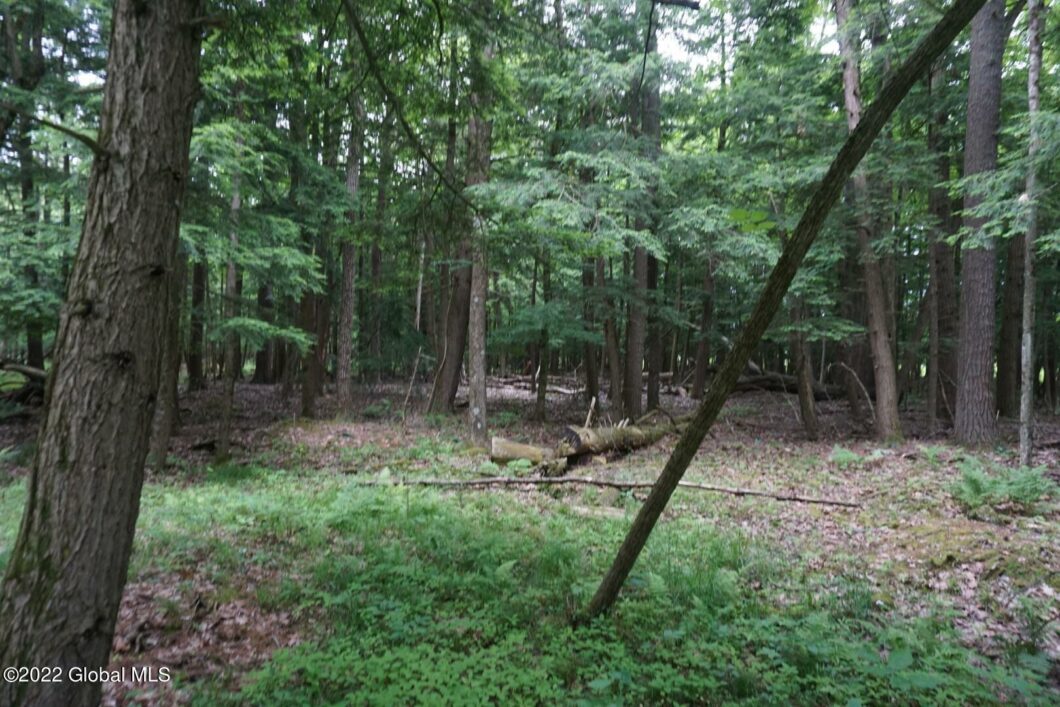
Almost impossible to find this size parcel under $100k. Property is level and wooded in the front with deer and other wildlife, wetlands in the back for the waterfowl. Possible home or business sites along the road frontage. Would also be a great prooperty to build a camp. Easy drive to the Capital District.
View full listing detailsPrice: | $99,900 |
---|---|
Address: | 0 Highway Route 20 |
City: | Carlisle |
State: | New York |
Zip Code: | 12031 |
MLS: | 202220685 |
Acres: | 66.530 |
Lot Square Feet: | 66.530 acres |
associationYN: | no |
---|---|
buyerAgencyCompensation: | 2.5 |
cityTownMail: | Carlisle |
compensationDisclaimer: | The listing broker's offer of compensation is made only to participants of the MLS where the listing is filed. |
currentUse: | Unimproved |
directions: | From Cobleskill, Main Street to left at Barnerville Road, take Myers Road, to Lawton Rd, and Beckers Corners Road to left on Highway Route 20 W. Property on right in approx 1 mile. |
documentCount: | 4 |
dualVariableCompensationYN: | No |
lotFeatures: | Level, Mineral Rights Excluded, Road Frontage, Timber, Wetlands, Wooded |
otherStructures: | None |
possession: | At Closing |
schoolDistrict: | Cobleskill-Richmondville |
sewer: | None |
specialListingConditions: | Standard |
taxAnnualAmount: | 1176 |
totalTaxesDescription: | Actual |
waterSource: | None |
waterfrontYN: | no |
![0 Highway Route 20](https://cdn.photos.sparkplatform.com/glo/20220621182904770969000000-o.jpg)
![0 Highway Route 20](https://cdn.photos.sparkplatform.com/glo/20220621182352806343000000-o.jpg)
![0 Highway Route 20](https://cdn.photos.sparkplatform.com/glo/20220621182845841176000000-o.jpg)
![0 Highway Route 20](https://cdn.photos.sparkplatform.com/glo/20220621182850412375000000-o.jpg)
![0 Highway Route 20](https://cdn.photos.sparkplatform.com/glo/20220621182853098398000000-o.jpg)
![0 Highway Route 20](https://cdn.photos.sparkplatform.com/glo/20220621182855649013000000-o.jpg)
![0 Highway Route 20](https://cdn.photos.sparkplatform.com/glo/20220621182858240541000000-o.jpg)
![0 Highway Route 20](https://cdn.photos.sparkplatform.com/glo/20220621182843395796000000-o.jpg)
![0 Highway Route 20](https://cdn.photos.sparkplatform.com/glo/20220621182901265105000000-o.jpg)
![0 Highway Route 20](https://cdn.photos.sparkplatform.com/glo/20220621182907291625000000-o.jpg)
![0 Highway Route 20](https://cdn.photos.sparkplatform.com/glo/20220621182911874276000000-o.jpg)
![0 Highway Route 20](https://cdn.photos.sparkplatform.com/glo/20220621182917935704000000-o.jpg)
![0 Highway Route 20](https://cdn.photos.sparkplatform.com/glo/20220621182923998712000000-o.jpg)
![0 Highway Route 20](https://cdn.photos.sparkplatform.com/glo/20220621182926994951000000-o.jpg)
![0 Highway Route 20](https://cdn.photos.sparkplatform.com/glo/20220621182930003155000000-o.jpg)
![0 Highway Route 20](https://cdn.photos.sparkplatform.com/glo/20220621182932271815000000-o.jpg)
![0 Highway Route 20](https://cdn.photos.sparkplatform.com/glo/20220621182848054759000000-o.jpg)
![0 Highway Route 20](https://cdn.photos.sparkplatform.com/glo/20220621182934575712000000-o.jpg)
![0 Highway Route 20](https://cdn.photos.sparkplatform.com/glo/20220621182936297533000000-o.jpg)